

IHRF CC:
International Height Reference Frame Coordination Center
IHRF CC
is a central coordinating body responsible for managing and maintaining the International Height Reference System (IHRS) & the International Height Reference Frame (IHRF).
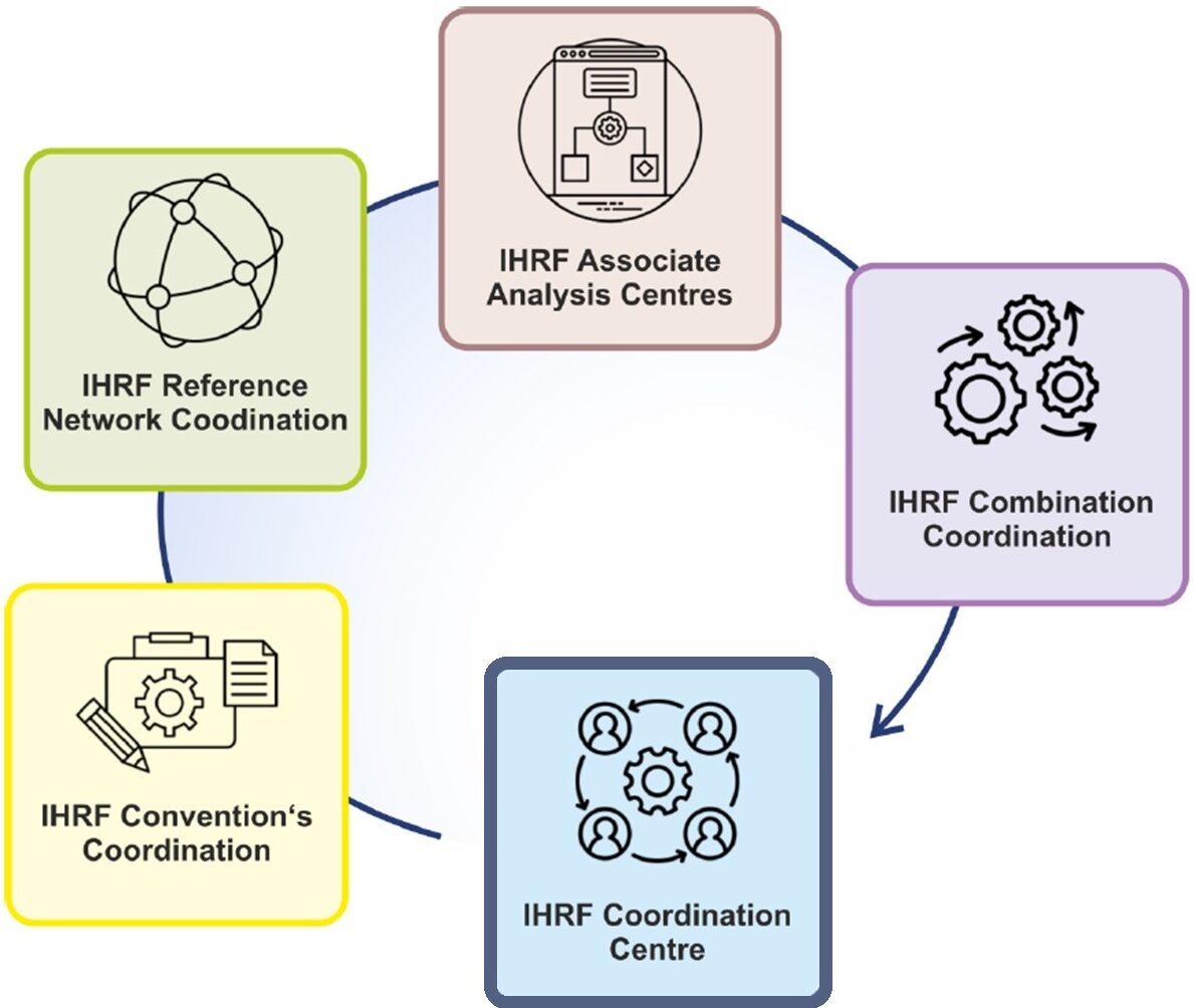
It operates under the International Gravity Field Service (IGFS) and oversees, through its permanent components (Coordination Center, Conventions’ Coordination, Reference Network Coordination, Associate Analysis Centres, and Combination Coordination), various components involved in realizing and sustaining the IHRS/IHRF.
.

IHRFCC Objectives

Coordination
IHRF CC serves as the linchpin for maintaining and advancing the integrity of the International Height Reference Frame (IHRF). Through meticulous coordination of network operations, adherence to conventions, and collaboration with global geodetic bodies, the IHRF CC ensures the accuracy and reliability of official height solutions while aligning with international standards and initiatives.

Coordinates
IHRF CC is committed to delivering precise and reliable solutions for the International Height Reference System (IHRS), including accurate coordinates of reference stations and vertical datum parameters. Through meticulous oversight of computation processes, our aim is to ensure the availability of up-to-date IHRS solutions meeting the highest standards for various applications in geodesy and related fields.

Collaboration
IHRF CC actively promotes scientific collaboration to advance the development and refinement of the IHRS/IHRF. Through engagement in initiatives such as the FA-UHS and participation in IAG commissions and committees, we facilitate global cooperation among researchers to enhance the accuracy and reliability of the IHRS/IHRF for future applications.

IHRFCC Goal
is to deliver high-quality IHRF solutions and related products to support a wide range of scientific, engineering, and societal applications that rely on precise height information
This involves coordinating the efforts of various components such as network coordination, conventions’ coordination, analysis center operations, and solution combination. The CC aims to provide accurate and reliable coordinates of IHRF reference stations, along with vertical datum parameters, to support global geodetic endeavors. Additionally, the CC seeks to foster international collaboration and advance scientific understanding in geodesy, facilitating the development of improved methods and technologies for height determination on a global scale.
Meet Our Geodetic Organizations:
Know us better:
- International Association of Geodesy (IAG)
- International Gravity Field Service (IGFS)
- Bureau Gravimetrique International (BGI)
- International Service for the Geoid (ISG)
- International Centre for Global Earth Models (ICGEM)
- International Combination Service for Time-variable Gravity Fields (COST-G)
- International Geodynamics and Earth Tide Service (IGETS)
